Vermont New Hampshire Raised Relief Map (Raven)
Vermont & New Hampshire Raised Relief Map: Discover the captivating landscapes of the Green Mountain and Granite States with this Vermont & New Hampshire Raised Relief Map. This three-dimensional map provides a stunning, tactile exploration of the area's peaks, valleys, rivers, and towns. Perfect for nature enthusiasts, adventurers, or anyone with a love for these picturesque states, this map beautifully captures the diverse geography of Vermont and New Hampshire. Made of durable molded plastic, it showcases every twist and turn of the terrain at a scale of 1:500,000.
Vermont & New Hampshire Raised Relief Map Peaks & Ranges: Experience the majesty of Vermont and New Hampshire’s towering summits and expansive mountain ranges. The map features Mount Washington, the highest peak in the Northeastern United States at 6,288 feet, standing proudly within the Presidential Range of the White Mountains. The map also showcases Vermont’s Green Mountains, including Mount Mansfield, the state’s highest peak at 4,393 feet. From the iconic Franconia Ridge to the rolling hills of the Taconic Range, each elevation is accurately represented, inviting you to explore these rugged landscapes from the comfort of your home.
Vermont & New Hampshire Raised Relief Map Geographic Features: Beyond the mountains, this map reveals the intricate waterways and charming towns that define Vermont and New Hampshire. Follow the winding course of the Connecticut River as it carves its way along the border between the two states, or trace the shores of Lake Champlain, the largest body of freshwater in the region. Discover Lake Winnipesaukee, a jewel nestled in New Hampshire’s Lakes Region, or spot the many smaller rivers, streams, and valleys that make this area so diverse and unique. Every detail, from forested highlands to fertile valleys, is captured with precision.
Vermont & New Hampshire Raised Relief Map Scale & Design: Crafted with care, this raised relief map uses a scale of 1:500,000, where 1 inch represents 8 miles. With dimensions of 22.5” x 32.5”, it provides an eye-catching wall display while remaining practical for close-up study. The molded plastic material is durable and lightweight, and all major towns, rivers, lakes, and mountains are clearly labeled, making it both an educational tool and a decorative piece. Embrace the topography of Vermont and New Hampshire in a way that flat maps simply can’t replicate.
** Raised Relief Maps are printed on vinyl and are not intended to roll and/or fold. We ship them in a flat box and pack them with love (i.e. Plenty of bubble wrap!) **
Price each
| Photo | Description | SKU | Units | Price | Qty | |
|---|---|---|---|---|---|---|
/1004/images/1201480.jpg)
|
Vermont & New Hampshire Raised Relief Map - 22.5" x 32.5" | AEPVTNH959 |
$86.95
|
|
Add to cart
|
|
| You Might Also Like: | ||||||
| Photo | Description | SKU | Units | Price | Qty | |
/1004/images/1186079.jpg)
|
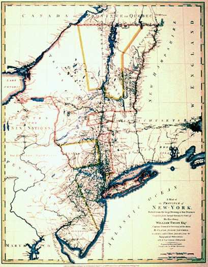
Antique Map of New England 1780 14.5" x 17.75" / With border~ 17.5" x 23" |
HISNE |
$19.95
|
|
Add to cart
|
|
/1004/images/1180059.jpg)
|
Maine Raised Relief Map (Raven colors) Maine Raised Relief Map - 22.5" x 32.5" |
AEPME955 |
$86.95
|
|
Add to cart
|
|
/1004/images/1189593.jpg)
|
White Mtn National Forest - Presidential Range & Grorham - NH/ME 27" x 39"|1:60,360 |
TRA741 |
$14.95
|
|
Add to cart
|
|
/1004/images/1200902.jpg)
|
Lake Winnipesaukee, NH Wood Chart Lake Winnipesaukee, NH Wood Chart - 24.5" x 31"|Dark Frame |
MINWINN-DF |
$375.00
|
|
Add to cart
|
|
/1004/images/1200902.jpg)
/1004/site-assets/logo.png)
/1004/site-assets/phone.png)
/1004/site-assets/cart.png)
/1004/images/1201480.jpg)
/1004/images/1201478.jpg)
/1004/images/1201479.jpg)
/1004/site-assets/dateseal.jpg)
/1004/site-assets/creditcards.png)