/1004/site-assets/phone.png)
/1004/site-assets/cart.png)
/1004/images/1201379.jpg "Arizona 3D Raised Relief Map")
/1004/images/1201378.jpg "Arizona 3D Raised Relief Map - Detail")
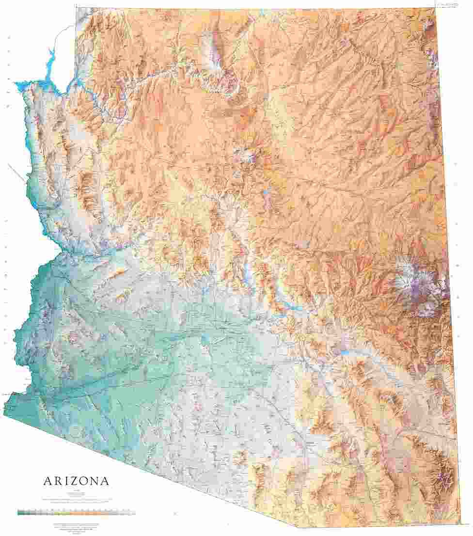
Arizona Raised Relief Map (Raven colors)
Arizona Raised Relief Map: Experience the captivating geography of the Grand Canyon State with this beautifully crafted Arizona Raised Relief Map. Designed to bring the diverse landscapes of Arizona to life, this map offers a unique, hands-on way to explore the state's natural wonders.
Arizona Raised Relief Map Peaks & Ranges: Crafted from durable molded plastic, this map features raised relief to emphasize Arizona's varied topography. From the soaring heights of Humphreys Peak, the tallest point in the state at 12,633 feet, to the rugged cliffs of the Mogollon Rim, elevations are carefully rendered in stunning detail. This map provides a tactile representation of Arizona's majestic mountain ranges, including the San Francisco Peaks, the White Mountains, and the Superstition Mountains, each of which contributes to the state's dramatic scenery.
Arizona Raised Relief Map Scale & Design: With a scale of 1:1,125,000, or 1 inch representing 18 miles, the Arizona Raised Relief Map strikes the perfect balance between detail and breadth, allowing you to see the entire state at a glance while still capturing its essential features. Major rivers like the Colorado, Gila, and Salt are clearly labeled, weaving their way through the valleys and deserts. The iconic Grand Canyon, one of the Seven Natural Wonders of the World, is highlighted with its intricate network of canyons and the mighty Colorado River carving its way through the rock layers.
Arizona Raised Relief Map Geographic Features: Lakes such as Lake Powell and Lake Mead, vital sources of water in this arid region, are also prominently featured. Towns and cities, from bustling Phoenix to historic Tombstone, are clearly marked, making it easy to locate places of interest and trace your travels or future adventures.
Whether you're a geography enthusiast, an Arizona native, or someone with a deep appreciation for the Southwest, this Arizona Raised Relief Map offers a visually engaging and educational tool. Perfect for classrooms, offices, or as a conversation piece in your home, it’s a map that truly brings Arizona's landscape to life, making it a must-have for anyone looking to explore the state's natural beauty in a new dimension.
** Raised Relief Maps are printed on vinyl and are not intended to roll and/or fold. We ship them in a flat box and pack them with love (i.e. Plenty of bubble wrap!) **
Price each
| Photo | Description | SKU | Units | Price | Qty | |
|---|---|---|---|---|---|---|
/1004/images/1201379.jpg "Arizona 3D Raised Relief Map")
|
Arizona Raised Relief Maps - 24" x 28" | AEPAZ961 |
$86.95
|
|
Add to cart
|
|
| You Might Also Like: | ||||||
| Photo | Description | SKU | Units | Price | Qty | |
/1004/images/1192584.jpg "Arizona State Wall Map with Shaded Relief by Raven Maps")
|
Arizona Wall Map l Raven Maps 42" x 51"|Paper |
RAVAZP |
$50.00
|
|
Add to cart
|
|
/1004/images/1189236.jpg "Arizona Wall Map National Geographic")
|
Arizona Wall Map by National Geographic 33" x 41"|Laminated |
NGSAZL |
$35.00
|
|
Add to cart
|
|
|
|
Arizona Wall Map by National Geographic 33" x 41"|Paper |
NGSAZP |
$19.99
|
|
Add to cart
|
|
/1004/images/1184803.jpg "Arizona & New Mexico 1867 Antique Map Replica")
|
Antique Map of Arizona and New Mexico 1867 36" x 29" |
KROLCAZNM1867 |
$34.95
|
|
Add to cart
|
|
/1004/site-assets/dateseal.jpg "Serving Seattle since 1950")
/1004/site-assets/creditcards.png)