/1004/images/1174948.jpg)
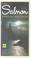
Challis National Forest Map - ID, Salmon-Challis Region
SKU: NFIDCH
$19.95
Large topographical recreation map for the Challis National Forests in the Salmon-Challis region of Idaho. On waterproof, tear resistant paper!
Features: Contour lines every 50 meters, roads, lakes, rivers, trails, bike trails, ORV trails, campsites, horse facilities, and winter & water recreation information.
Price each
| Photo | Description | SKU | Units | Price | Qty | |
|---|---|---|---|---|---|---|
/1004/images/1174948.jpg)
|
63" x 44"|1:126,720 | NFIDCH |
$19.95
|
|
Out of stock
|
|
| You Might Also Like: | ||||||
| Photo | Description | SKU | Units | Price | Qty | |
/1004/images/1180608.jpg)
|
Idaho Recreational Road Map by Benchmark 26" x 38"|1:833,333 |
NGSBENID |
$7.95
|
|
Add to cart
|
|
/1004/images/1197885.jpg)
|
Frank Church Wilderness, South Map - ID 31" x 41"|1:100,000 |
NFIDFSW |
$19.95
|
|
Add to cart
|
|
/1004/images/1198650.jpg)
|
Frank Church Wilderness, North Map - ID 31" x 41"|1:100,000 |
NFIDFNW |
$19.95
|
|
Add to cart
|
|
/1004/images/1180610.jpg)
|
Idaho Recreational Atlas by Benchmark 11" x 16" |
NGSBENIDAT |
$26.95
|
|
Add to cart
|
|
/1004/images/1192589.jpg)
|
Idaho Wall Map l Raven Maps 42" x 65"|Laminated |
RAVIDL |
$75.00
|
|
Add to cart
|
|
/1004/images/1192589.jpg)
|
Idaho Wall Map l Raven Maps 42" x 65"|Paper |
RAVIDP |
$50.00
|
|
Add to cart
|
|
Price
$19.95
Quantity
Price
$7.95
Quantity
Price
$19.95
Quantity
Price
$19.95
Quantity
Price
$26.95
Quantity
Price
$75.00
Quantity
Price
$50.00
Quantity
You Previously Viewed:
/1004/site-assets/logo.png)
/1004/site-assets/phone.png)
/1004/site-assets/cart.png)

/1004/site-assets/dateseal.jpg)
/1004/site-assets/creditcards.png)