/1004/site-assets/phone.png)
/1004/site-assets/cart.png)
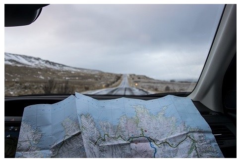
How To Read A Map
For over 5,000 years, maps have kept humans moving in the right direction.
Christopher Columbus, Ferdinand Magellan, and Lewis and Clark used maps to guide them, and they added to the maps so that future travelers could find their way around.
Using a map gives you a sense of what early explorers must have felt. It also brings a sense of accomplishment when you follow one correctly. It's part of the fun of getting where you need to go.
How do you read and use it to reach your next destination? This article covers everything you need to know. Let's explore! Types of Maps
There are different maps available for different needs. Each map is tailor-made for a specific purpose, for example:
Road Maps: These maps are ideal for planning road trips or navigating city streets. They provide detailed information about highways, major roads, secondary roads, and other essential landmarks...folded State Highway Maps for example.
Topographic Maps: Also called topo maps, these maps are perfect for outdoor activities like hiking and camping. They showcase natural features with colors and contour lines representing elevation, terrain features, and even remote locations. For more about how to read topographic maps, click here.
Political Maps: Political maps highlight boundaries such as countries, states, and cities. They provide a broader understanding of the world's geography, making them useful for educational purposes....such as this World Map that also features flags.
Physical Maps: Physical Maps show natural and physical features such as mountains, plateaus, plains, rivers, oceans, etc. Sometimes Physical Maps will also use contour lines and shaded relief to represent changes in elevation and shape and give a visual representation of terrain features. This United States Map is a beautiful example.
Travel Maps: Travel maps are designed for tourists, travelers and visitors. They often include key tourist attractions, popular destinations, and helpful information like hotels, restaurants, and transportation options. Our huge selection of International Travel Maps represent this map type!
Parts of a Map
Maps share certain characteristics, and by learning them, you can use a map to understand the area around you and find your way around.
The Index
The index is a list or chart that helps you locate specific areas or features on the map, such as cities or scenic areas. The index is usually made up of names of spots on the map and corresponding numbers or symbols that relate to horizontal and vertical grid lines on the map so that you can find them. The order of numbers and letters are indicated in consecutive order to make it easy for you to find where they meet to get a general idea of where that named city or location is.
The Legend
Also known as a key, a legend indicates the meaning of various symbols, colors, and patterns used on the map to help you find specific information other than the name of a city or geographic area. Symbols can include historical sites, campgrounds, parks, scenic areas, etc.
The Compass Rose
The compass rose indicates north, south, east, and west on the map. It is one of the most important features on a map because it helps you maintain your direction of travel to keep you from becoming lost. For a little more depth on the importance of the compass rose and how it's used, see our article What is a Compass Rose?
The Scale
The scale on a paper map indicates distances on the map. It provides a ratio you can use to determine distance. For example, a common scale is a ratio, such as "1:10,000." It means that one unit of measurement on the map (say, 1 inch) represents 10,000 of that same measurement unit in reality. You can measure the distance between two points on the map to understand the total distance between two points. A deeper dive on Map Scales can be found here!
Grid Lines
One type of map grid is a series of imaginary vertical and horizontal lines that form a network of squares on the map that relate to the index. One series of lines is typically represented by a letter, while the perpendicular lines are represented by numbers. The letters are in alphabetical order, and the numbers are in numerical order. The squares created by these lines are then referenced by the map index. Grid lines may also indicate different reference measurements like longitudes and latitudes in atlases and topographical maps or township and range divisions on property maps.
Contour Lines
Contour lines are outlines of specific features of a map. The contour lines work like overhead slices of the land to depict elevation changes to help you understand the terrain. For example, a mountain will have numerous contour lines that look like the rings of a tree trunk, but instead of indicating age, they indicate elevation changes. The closer the contour lines are together, the steeper the terrain. The farther they are apart, the gentler the slope. These are typically found only on topographic or hiking maps, here is more information on understanding contour lines and reading topo maps.
Understanding the distances between the lines gives you a three-dimensional representation on a two-dimensional piece of paper.
Colors
Different colors on the map provide information about the land and its features. For instance, green often represents vegetation like forests or parks, and blue typically depicts bodies of water, like rivers, lakes, or oceans. Other colors can indicate changes in elevation or dryness. Boundaries are sometimes noted with different topographical colors or grey dashes.
Even just the individual lines can have colors that mean different things in the legend, such as brown lines for contour lines or black lines for roads.

How to Use a Map
Start by identifying your current location on the map by comparing it with recognizable features in your surroundings. You can use landmarks or features on the map, such as roads or rivers, to further confirm your orientation. Then turn the map so that it mirrors what you see ahead of you in real life.
Now look at the compass rose to determine the north, south, east, west, and magnetic north. You can use a compass to assist you in maintaining a magnetic direction as you walk to reach a desired area. Here are helpful tips about How to Use Your Compass with your map.
How to Chart Your Path
Use the index to find the grid coordinates for your current location and final destination. As we said earlier, grid lines help you determine your current location and provide a sense of direction using a square pattern of vertical and horizontal lines over the area. Grid coordinates aren't always 100% accurate since the squares aren't entirely precise. Still, they give you an understanding of where the indexed item is and where to go.
If your gridlines are latitude or longitude, you can use them with your compass to guide you.
Now Start Exploring!
Confirm sites on the map along your journey to ensure you stay on the right path. And once your trip is over, hold onto that map! It will bring back fond memories of that trip.
/1004/site-assets/dateseal.jpg "Serving Seattle since 1950")
/1004/site-assets/creditcards.png)