/1004/images/1193060.jpg)
Voyageurs Paddle Routes Map - MN
SKU: TRA410
$11.95
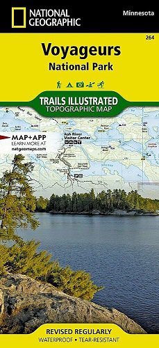
Trails Illustrated Map #410 Voyageurs Paddle Routes, published by National Geographic.
Voyageurs National Park is located at the border of Minnesota and Ontario, Canada. Located at the east end of the park is a water wonderland that can be explored by kayak, canoe, motorboat or houseboat.
Routes are shown for six specific paddle routes: Rainy Lake West, Rainy Lake East, Sand Point Lake, Kabetogama Lake, Namakan Lake and the Chain-of-Lakes Route.
- 1" = 1.1 miles / 1 cm = .7 km
- Lake Contour Interval 10 feet
- Waterproof and tear-resistant
Price each
Price
$11.95
Quantity
Price
$14.95
Quantity
Price
$14.95
Quantity
Price
$11.95
Quantity
Price
$26.95
Quantity
Price
$42.95
Quantity
Price
$332.00
Quantity
Price
$332.00
Quantity
/1004/images/1185024.jpg)
KROLCMIN1849
Price
$34.95
Quantity
/1004/images/1185042.jpg)
KROLCMN1874
Price
$39.95
Quantity
Price
$14.95
Quantity
You Previously Viewed:
/1004/site-assets/logo.png)
/1004/site-assets/phone.png)
/1004/site-assets/cart.png)
/1004/images/1193060.jpg)
/1004/images/1189862.jpg)
/1004/images/1189831.jpg)
/1004/images/1198383.jpg)
/1004/images/1190164.jpg)
/1004/images/1188567.jpg)
/1004/images/1194340.jpg)
/1004/images/1193061.jpg)


/1004/site-assets/dateseal.jpg)
/1004/site-assets/creditcards.png)