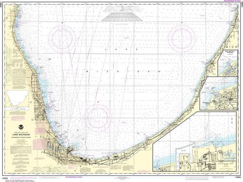
Nautical Chart 14904 (Lake Michigan) Port Washington to Waukegan
SKU: NOS14904
$26.95
Nautical chart of part of Lake Michigan including Port Washington, Milwaukee, Racine, Kenosha Harbor and Waukegan. Large, rolled up and full of detail...ideal for navigation or hanging on a wall!
Available in paper or Tyvek (water and tear-resistant)
To the south is chart #14905
To the north is chart #14903
Price each
Price
$26.95
Quantity
/1004/images/1190287.jpg)
Price
$42.95
Quantity
Price
$375.00
Quantity
Price
$375.00
Quantity
Price
$26.95
Quantity
Price
$42.95
Quantity
Price
$26.95
Quantity
/1004/images/1190287.jpg)
Price
$42.95
Quantity
Price
$26.95
Quantity
Price
$42.95
Quantity
/1004/images/1185033.jpg)
KROLCMIC1876
Price
$35.95
Quantity
Price
$26.95
Quantity
Price
$21.95
Quantity
Price
$153.00
Quantity
Price
$42.95
Quantity
You Previously Viewed:
/1004/site-assets/logo.png)
/1004/site-assets/phone.png)
/1004/site-assets/cart.png)
/1004/images/1190287.jpg)
/1004/images/1200875.jpg)
/1004/images/1200872.jpg)
/1004/images/1190177.jpg)
/1004/images/1190157.jpg)
/1004/images/1190245.jpg)


/1004/site-assets/dateseal.jpg)
/1004/site-assets/creditcards.png)