Antique Map of Tokyo 1854
SKU: HISTK
$44.95
In 1854, when this map of Tokyo was originally published, Commodore Matthew Perry brought his fleet to Tokyo Bay to negotiate the first commercial treaty with Japan.
Crests indicate the palaces of noble families, and a legend gives distances from the city's center to outlying locations.
Printed by Historic Urban Plans.
Articles
Price each
| Photo | Description | SKU | Units | Price | Qty | |
|---|---|---|---|---|---|---|
/1004/images/1186064.jpg)
|
27" x 19.75" | HISTK |
$44.95
|
|
Add to cart
|
|
| You Might Also Like: | ||||||
| Photo | Description | SKU | Units | Price | Qty | |
/1004/images/1185185.jpg)
|
Antique Map of Tokyo, Japan 1852 36" x 21" |
KROLCTOK1852 |
$32.95
|
|
Add to cart
|
|
/1004/images/1192853.jpg)
|
Antique Map of Japan 1888 36" x 26" |
KROLCJAP1888 |
$39.95
|
|
Add to cart
|
|
/1004/images/1184987.jpg)
|
Antique Map of Japan 1855 36" x 32" |
KROLOCJAPAN1855 |
$39.95
|
|
Add to cart
|
|
/1004/images/1198087.jpg)
|
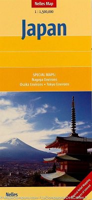
Tokyo Travel Map l ITM 27" x 39"|1:600,000 & 1:15,100 |
ITMTOK |
$14.95
|
|
Add to cart
|
|
Price
$44.95
Quantity
/1004/images/1185185.jpg)
KROLCTOK1852
Price
$32.95
Quantity
/1004/images/1192853.jpg)
KROLCJAP1888
Price
$39.95
Quantity
/1004/images/1184987.jpg)
KROLOCJAPAN1855
Price
$39.95
Quantity
Price
$14.95
Quantity
You Previously Viewed:
/1004/site-assets/logo.png)
/1004/site-assets/phone.png)
/1004/site-assets/cart.png)
/1004/images/1186064.jpg)


/1004/site-assets/dateseal.jpg)
/1004/site-assets/creditcards.png)