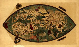
Antique Map of France 1724
SKU: KROLCFRA1724
$35.95
This antique map of France from 1724 uses color to illustrat political boundaries includes illustrations and has an alphabetized index of place names.
Articles
Price each
| Photo | Description | SKU | Units | Price | Qty | |
|---|---|---|---|---|---|---|
|
|
36" x 21" | KROLCFRA1724 |
$35.95
|
|
Add to cart
|
|
| You Might Also Like: | ||||||
| Photo | Description | SKU | Units | Price | Qty | |
/1004/images/1190694.jpg)
|
Paris Map Print Dark Blue by Point Two 13" x 19" |
PTMPARISDRKBLU |
$34.00
|
|
Add to cart
|
|
/1004/images/1188981.jpg)
|
France Wall Map by National Geographic 30" x 23"|Paper |
NGSFRA |
$19.95
|
|
Add to cart
|
|
/1004/images/1188981.jpg)
|
France Wall Map by National Geographic 30" x 23"|Laminated |
NGSFRA-lam |
$29.95
|
|
Add to cart
|
|
/1004/images/1180773.jpg)
|
France Type Map - Slate 27 1/2" x 19 3/4"|Paper |
BANFRAS |
$65.00
|
|
Add to cart
|
|
/1004/images/1189026.jpg)
|
France Executive Wall Map by National Geographic 30" x 23"|Laminated |
NGSFRAEL -lam |
$29.95
|
|
Out of stock
|
|
/1004/images/1184951.jpg)
KROLCFRA1724
Price
$35.95
Quantity
/1004/images/1190694.jpg)
PTMPARISDRKBLU
Price
$34.00
Quantity
Price
$19.95
Quantity
Price
$29.95
Quantity
Price
$65.00
Quantity
Price
$29.95
Quantity
You Previously Viewed:
/1004/site-assets/logo.png)
/1004/site-assets/phone.png)
/1004/site-assets/cart.png)
/1004/images/1184951.jpg)

/1004/site-assets/dateseal.jpg)
/1004/site-assets/creditcards.png)