/1004/site-assets/phone.png)
/1004/site-assets/cart.png)
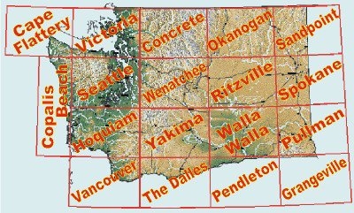
Washington State Regional Raised Relief Maps
Washington State Regional Raised Relief Maps: Step into the beautiful and diverse landscapes of Washington State with these raised relief maps! Whether you’re dreaming of the rugged peaks of the Cascades, the lush beauty of the Olympic Peninsula, or the charming coastlines of the Puget Sound, these maps have you covered. Each map brings the Evergreen State’s topography to life in delightful 3D detail, so you can practically feel the rise of Mount Rainier or the dip of the Columbia River. Perfect for geography buffs, adventurers, and anyone with a love for Washington’s natural wonders, these maps make exploring your favorite regions a whole lot more fun!
***Unfortunately many titles are no longer in print...if the map isn't listed below,
then the publisher has discontinued that map***
** Raised Relief Maps are printed on vinyl and are not intended to roll and/or fold.
We ship them in a flat box and pack them with love (i.e. Plenty of bubble wrap!) **
** PLEASE NOTE: When mailing items to the Aloha State of Hawaii and the Last Frontier of Alaska,
additional fees may be required for shipment. **
.
/1004/images/1201562.jpg "Concrete, WA Regional Raised Relief Map 3D")
/1004/images/1201581.jpg "Grangeville Area Raised Relief Map 3D")
/1004/images/1201663.jpg "Portland Area Raised Relief Map by Summit 3D")
/1004/images/1201585.jpg "Sandpoint Area Raised Relief Map 3D")
/1004/images/1201592.jpg "Seattle Area Raised Relief Map 3D")
/1004/images/1201651.jpg "Seattle Area Raised Relief Map by Summit 3D")
/1004/images/1201476.jpg "Washington State Raised Relief Map 3D")
/1004/images/1201697.jpg "Washington State Raised Relief Map 3D")
/1004/images/1201596.jpg "Wenatchee Area Raised Relief Map 3D")
/1004/images/1201600.jpg "Yakima Area Raised Relief Map 3D")
/1004/site-assets/dateseal.jpg "Serving Seattle since 1950")
/1004/site-assets/creditcards.png)