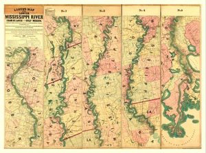
Antique Map of Mississippi River 1858
SKU: KROLCMIS1858
$30.95
The "Norman's Chart of Lower Mississippi River, by A. Persac" is a nice antique map reprint originally published in 1858. Shows from Natchez to New Orleans and has a nicely illustrated border including a few illustrations!
Articles
Price each
| Photo | Description | SKU | Units | Price | Qty | |
|---|---|---|---|---|---|---|
/1004/images/1185055.jpg)
|
18" x 36" | KROLCMIS1858 |
$30.95
|
|
Add to cart
|
/1004/images/1185055.jpg)
Antique Map of Mississippi River 1858
18" x 36"
18" x 36"
KROLCMIS1858
Price
$30.95
Quantity
You Previously Viewed:
/1004/site-assets/logo.png)
/1004/site-assets/phone.png)
/1004/site-assets/cart.png)
/1004/images/1185055.jpg)

/1004/site-assets/dateseal.jpg)
/1004/site-assets/creditcards.png)