
The MapShop
San Francisco Bay Raised Relief Map
San Francisco Bay Raised Relief Map
Couldn't load pickup availability
Share
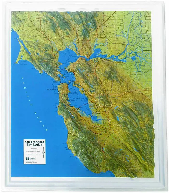
San Francisco Bay Raised Relief Map: Experience the breathtaking topography of one of the most iconic regions in the world with the San Francisco Bay Area Raised Relief Map. This carefully crafted map offers a stunning three-dimensional view of the area’s diverse landscapes, from the rugged coastline to the towering peaks of its mountain ranges. Made from durable molded plastic, this map is perfect for both educational and decorative purposes, bringing the natural beauty and complexity of the Bay Area right into your home or office.
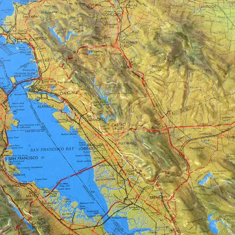
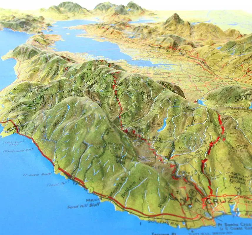
San Francisco Bay Raised Relief Map Peaks & Ranges: Explore the majestic heights of the Bay Area's most prominent mountain ranges. The map highlights Mount Diablo, the tallest peak in the region at 3,849 feet, offering sweeping views over much of Northern California. To the west, the Santa Cruz Mountains rise along the Pacific coast, with Loma Prieta standing out as its highest point. On the eastern side, the Berkeley Hills form a dramatic backdrop to the East Bay, while further north, the Marin Headlands provide a stunning view of the Golden Gate Bridge and San Francisco. These peaks and ranges are beautifully detailed, showcasing the varied elevations that define the Bay Area's unique geography.
San Francisco Bay Raised Relief Map Geographic Features: The San Francisco Bay Area Raised Relief Map also features the intricate network of rivers, lakes, and valleys that shape the region’s landscape. The map clearly labels the Sacramento and San Joaquin Rivers, which flow into the expansive San Francisco Bay, a vital estuary that serves as the heart of the region. You’ll find the winding course of the Russian River to the north and the fertile valleys of Napa and Sonoma, known for their world-renowned vineyards, are also depicted, along with the urban centers of San Francisco, Oakland, and San Jose, all accurately positioned and labeled.
** Raised Relief Maps are printed on vinyl and are not intended to roll and/or fold. We ship them in a flat box and pack them with love (i.e. Plenty of bubble wrap!) **