1
/
of
1
National Geographic
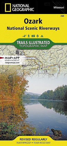
Ozark National Scenic Riverways Map
Ozark National Scenic Riverways Map
Regular price
$14.95 USD
Regular price
Sale price
$14.95 USD
Unit price
/
per
Couldn't load pickup availability
Share
Trails Illustrated Map #260 of Ozark National Scenic Riverways, published by National Geographic.
Two-sided waterproof and tear-resistant topographic map showing the western half, along Jacks Fork and Current River on one side, and the eastern half, along Current River and lowermost Jacks Fork on the other.
Roads, trails, horse and bike trails, the Ozark Trail, parts of Mark Twain National Forest and many other points of interest are clearly indicated.
- 1" = 1 mile / 1 cm = .6 km
- Contour Interval 50 feet