The MapShop
Oregon Raised Relief Map
Oregon Raised Relief Map
Couldn't load pickup availability
Share
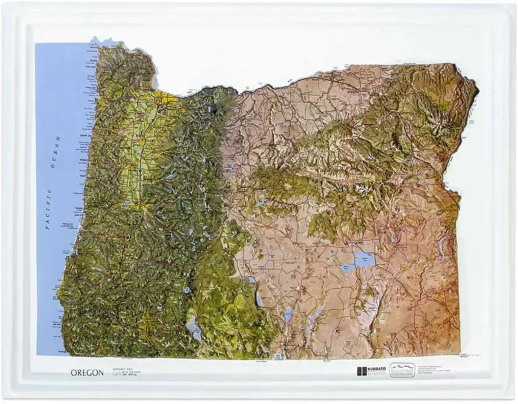
Oregon Raised Relief Map: Discover the stunning beauty of Oregon with this Oregon Raised Relief Map, a beautifully detailed 3D representation of the state’s diverse landscape. This map captures Oregon's unique geographical features in vivid detail, making it an ideal piece for both educational purposes and home décor. Crafted from molded plastic, it showcases the state’s topography with an impressive scale of 1:1,400,000 (approximately 1" = 22 miles), allowing you to explore Oregon’s dramatic elevations and geographical nuances in a compact 22” x 17” format.
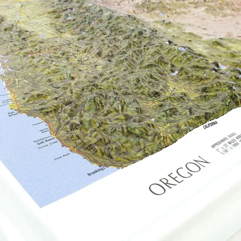
Oregon Raised Relief Map Peaks & Ranges: At the heart of Oregon's landscape are its majestic mountain ranges and peaks, and this map brings them to life with remarkable clarity. The map highlights the towering Cascade Range, home to iconic peaks like Mount Hood, Oregon’s tallest mountain at 11,249 feet. Mount Jefferson and the Three Sisters are also prominently displayed, each contributing to the region's rugged charm. To the east, the map features the Wallowa Mountains, known for their striking granite formations and stunning vistas. This raised relief map provides a tactile experience of these high elevations, making it a perfect tool for hikers, climbers, and geography enthusiasts.
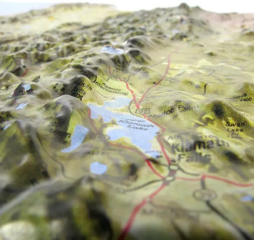
Oregon Raised Relief Map Geographic Features: The Oregon Raised Relief Map intricately details the state's varied geography, from its lush coastlines to its arid eastern regions. The map includes major rivers like the Columbia and Willamette, as well as large lakes such as Crater Lake, renowned for its deep blue waters and volcanic origins. Notable towns and cities are clearly labeled, allowing for easy identification and exploration. The map’s raised features vividly depict Oregon’s diverse terrain, including valleys, plateaus, and volcanic landscapes.
Oregon Raised Relief Map Scale & Design: The Oregon Raised Relief Map is designed with a scale of 1:1,400,000, providing an expansive view of the state while maintaining intricate details. The molded plastic construction ensures durability and a tactile experience of Oregon’s topography. Rivers, lakes, mountains, and towns are clearly labeled, making it both a functional reference and an attractive piece of wall art. Measuring 22” x 17”, this map fits perfectly in various settings, from classrooms to living rooms, making it a versatile addition to any space.
** Raised Relief Maps are printed on vinyl and are not intended to roll and/or fold. We ship them in a flat box and pack them with love (i.e. Plenty of bubble wrap!) **