logo
206.623.8747800.727.4430
MENU
logo
0 items | $0.00 | cart
Checkout

Mid-Atlantic Lighthouses Map by Bella Terra

SKU: BTPMATLIGHTF
$7.95

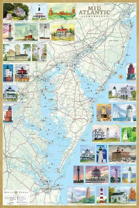
30 individual pictures of lighthouses of the Mid-Atlantic Coast - including New Jersey, Delaware, Maryland and Virginia.  

Other details include: locations of all standing and lost lighthouses, history, directions to view each one and a directory of maritime museums.  
The backside is an index with additional text about each lighthouse.

Price each

Photo Description SKU Units Price Qty cart-icon
Lighthouses Midatlantic Map Bella Terra 24" x 36" BTPMATLIGHTF
$7.95
Add to cart
You Might Also Like:
Photo Description SKU Units Price Qty cart-icon
Philadelphia Mid Atlantic Folded Road Compact Travel Map ITMB Mid-Atlantic & Philadelphia U.S. Road Map by ITM
27" x 39"|1:1,000,000 & 1:10,000
ITMPHILA
$10.95
New Edition Available - See ITMPHILAD
Lighthouses Massachusetts Rhode Island Map Bella Terra Massachusetts & Rhode Island Lighthouse Map by Bella Terra
24" x 36"
BTPMARILIGHTF
$6.95
Add to cart
Northeast American Coast 1715 Antique Map Replica Antique Map of North America / Northeast American Coastline 1715
22" x 36"
KROLCNEAC1715
$30.95
Add to cart
Delmarva Peninsula Topo Waterproof National Geographic Hiking Map Trails Illustrated Delmarva Peninsula - DE, MD, VA
27" x 39"|1:250,000
TRA772a
$14.95
Add to cart
Chesapeake Bay Nautical Watercolor Art Wall Map Chesapeake Bay Art Print & Poster
Chesapeake Bay Art Print - 18.5" x 23.5"| Paper
MAICBAY
$25.95
Add to cart
Chesapeake Bay Nautical Watercolor Art Wall Map Chesapeake Bay Art Print & Poster
Chesapeake Bay Art Print - 18.5" x 23.5"| Plak Mounted
MAICBAYCP
$175.00
Add to cart
You Previously Viewed:
logo

logo