National Geographic
Issaquah Alps - Mt Si Hiking Map
Issaquah Alps - Mt Si Hiking Map
Couldn't load pickup availability
Share
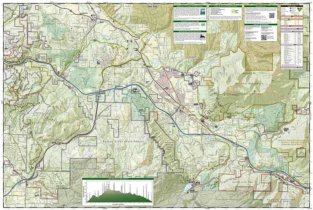
National Geographic Trails Illustrated Topographic Map #824: Issaquah Alps & Mount Si: Discover the breathtaking landscapes of Washington’s Issaquah Alps and Mount Si with National Geographic’s Trails Illustrated Topographic Map #824. This meticulously crafted map is your ultimate guide to exploring some of the Pacific Northwest’s most scenic and diverse terrain. Designed with adventurers in mind, it provides detailed topographic information, trail routes, and recreational features, ensuring you’re well-equipped for hiking, mountain biking, and backcountry exploration.
Highlighted in vibrant detail, this map covers iconic peaks like Mount Si, Tiger Mountain, and Cougar Mountain. It includes popular hiking trails such as the Mount Si Trail, known for its stunning views of the Snoqualmie Valley, and the Rattlesnake Ridge Trail, a favorite among outdoor enthusiasts. The map also features key natural landmarks, including the tranquil shores of Rattlesnake Lake and the lush forests of the Issaquah Alps, home to diverse wildlife and flora.
Each trail is marked with clear mileage indicators, difficulty levels, and trailhead locations, making it easy to plan your adventure. Points of interest such as picnic areas, campgrounds, and parking facilities are also prominently displayed. Printed on waterproof, tear-resistant paper, this map is built to withstand the elements and rigorous outdoor use.
Whether you’re a seasoned explorer or a weekend hiker, the National Geographic Trails Illustrated Topographic Map #824 is an indispensable tool for navigating and appreciating the rugged beauty of Washington’s Issaquah Alps and Mount Si.