The MapShop
Grand Teton National Park Raised Relief Map
Grand Teton National Park Raised Relief Map
Couldn't load pickup availability
Share
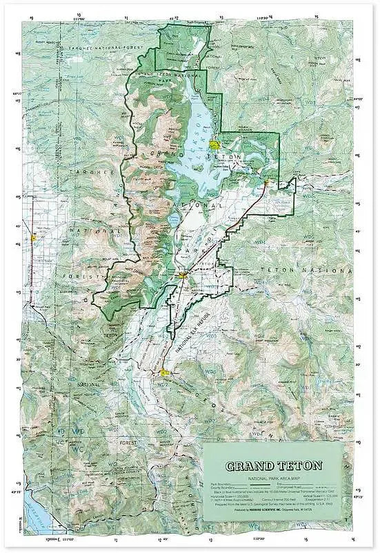
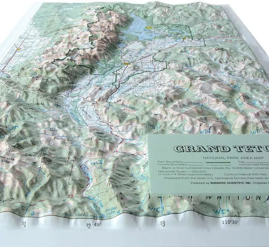
Grand Teton National Park Raised Relief Map: Explore the rugged beauty of Wyoming's Grand Teton National Park with this detailed Raised Relief Map, a stunning three-dimensional representation of one of America's most iconic landscapes. Perfect for adventurers, map enthusiasts, or as a unique décor piece, this map showcases the park’s towering peaks, majestic mountain ranges, and diverse geographical features in exquisite detail. Crafted from molded plastic, it brings the dynamic topography of Grand Teton to life, making it easy to appreciate the park’s dramatic elevations and natural splendor.
Grand Teton National Park Raised Relief Map Peaks & Ranges: Dominating the landscape of the map is the mighty Grand Teton, standing at 13,775 feet, the highest peak in the Teton Range. The map also highlights other significant peaks, including Mount Owen, Middle Teton, and South Teton, each contributing to the jagged skyline that defines the park. The Teton Range, part of the larger Rocky Mountains, is displayed in striking relief, allowing viewers to trace the sharp edges and steep inclines that make these peaks a magnet for climbers and hikers alike.
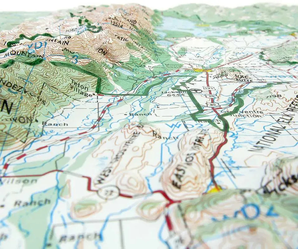
Grand Teton National Park Raised Relief Map Geographic Features: This Raised Relief Map not only showcases the stunning peaks but also the intricate network of rivers, lakes, and valleys that weave through the park. Prominently featured is Jackson Lake, one of the largest high-altitude lakes in the United States, alongside the winding Snake River, a key waterway that carves through the valley floor. Other notable features include Jenny Lake, a glacially-carved body of water nestled at the base of the Tetons, and the lush valley of Jackson Hole, framed by the dramatic mountain backdrop. These elements are intricately labeled, offering a comprehensive view of the park’s diverse terrain.
** Raised Relief Maps are printed on vinyl and are not intended to roll and/or fold. We ship them in a flat box and pack them with love (i.e. Plenty of bubble wrap!) **