Summit Terragraphics
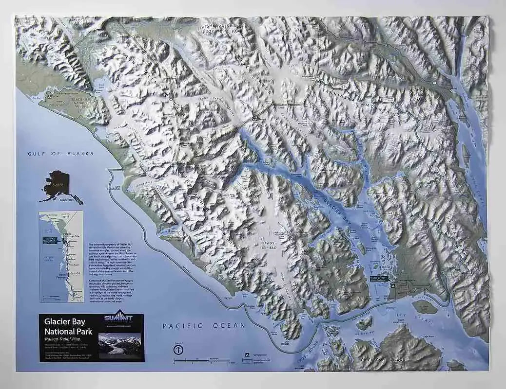
Glacier Bay National Park Raised Relief Map
Glacier Bay National Park Raised Relief Map
Couldn't load pickup availability
Share
Glacier Bay National Park Raised Relief Map: Immerse yourself in the breathtaking beauty of Alaska's wilderness with this Glacier Bay National Park Raised Relief Map. This detailed and meticulously crafted map brings the awe-inspiring landscapes of Glacier Bay to life, showcasing its dramatic peaks, expansive mountain ranges, and glacial features in stunning three-dimensional form. Whether you're a nature enthusiast, a hiker, or simply an admirer of the natural world, this map is the perfect way to explore one of America's most remote and magnificent national parks.
Glacier Bay National Park Raised Relief Map Peaks & Ranges: The Glacier Bay National Park Raised Relief Map prominently features the park's most towering peaks and sprawling mountain ranges. Marvel at the sight of Mount Fairweather, the park's highest point, reaching an impressive 15,325 feet, and the surrounding Fairweather Range, known for its rugged terrain and ice-capped summits. The map also highlights other notable peaks, including Mount Crillon and Mount La Perouse, offering a vivid representation of the park's diverse and majestic topography.
Glacier Bay National Park Raised Relief Map Geographic Features: Glacier Bay is renowned for its dramatic glaciers, fjords, and water features, all meticulously depicted on this raised relief map. You'll be able to trace the paths of iconic glaciers such as the Grand Pacific Glacier and the Margerie Glacier, both of which are integral to the park's unique landscape. The map also showcases the intricate network of fjords and inlets that make Glacier Bay a world-renowned destination for both adventure seekers and nature lovers. Key water features, including Glacier Bay itself, are labeled, providing a comprehensive view of the park's extraordinary geography.
Glacier Bay National Park Raised Relief Map Scale & Design: Crafted from molded plastic, the Glacier Bay National Park Raised Relief Map is not only a beautiful piece of art but also a functional tool for understanding the park's vast and varied terrain. With a scale of 1:310,000, or approximately 1 inch representing 5 miles, this map offers a detailed yet accessible view of Glacier Bay's landscape. Measuring 28 inches by 22 inches, it is perfectly sized for display in your home, office, or classroom, allowing you to explore the wonders of Glacier Bay in stunning detail.
** Raised Relief Maps are printed on vinyl and are not intended to roll and/or fold. We ship them in a flat box and pack them with love (i.e. Plenty of bubble wrap!) **