The MapShop
Colorado Raised Relief Map
Colorado Raised Relief Map
Couldn't load pickup availability
Share
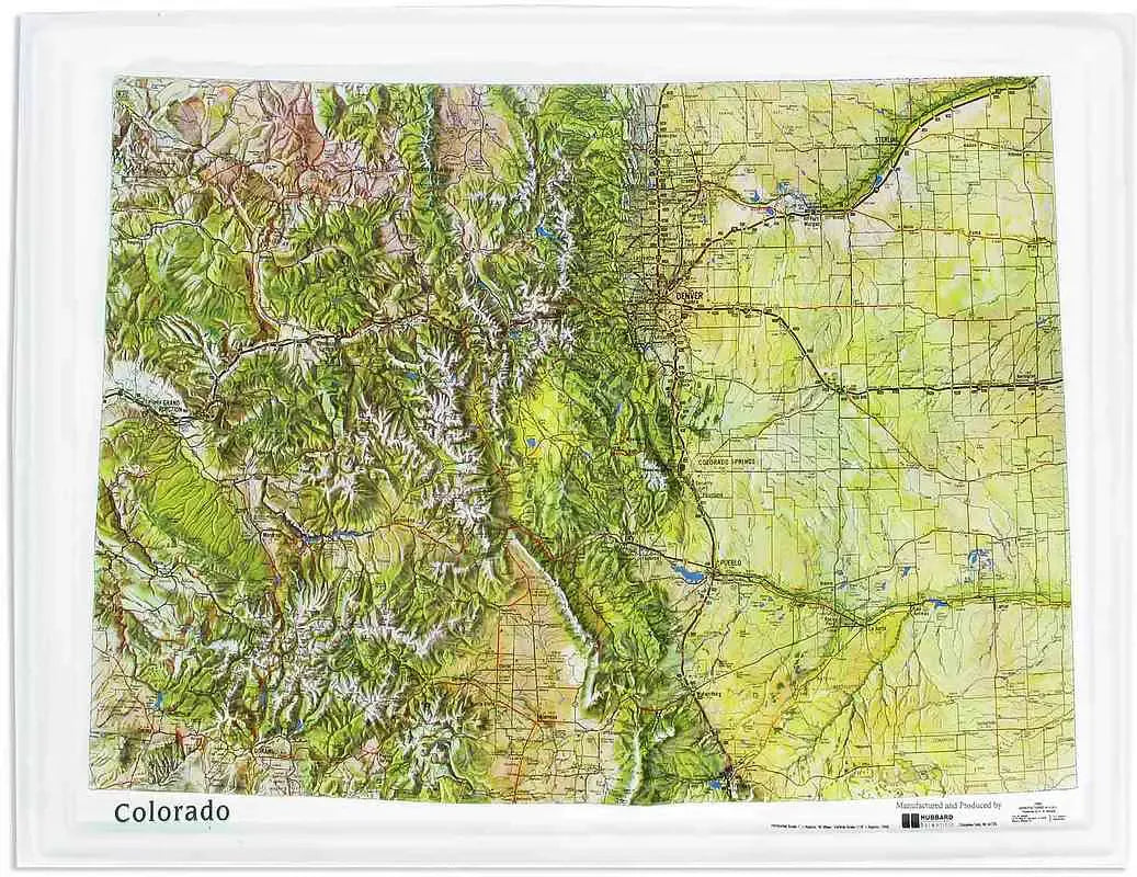
Colorado Raised Relief Map: Explore the rugged beauty of the Centennial State with your own Colorado Raised Relief Map, a stunning representation of the state's diverse topography. This detailed, molded plastic map captures Colorado's majestic peaks, expansive mountain ranges, and intricate waterways, offering an immersive way to appreciate the state's natural wonders. With carefully labeled rivers, lakes, mountains, and towns, this map is both a practical tool and a captivating piece of art for any home, office, or classroom.
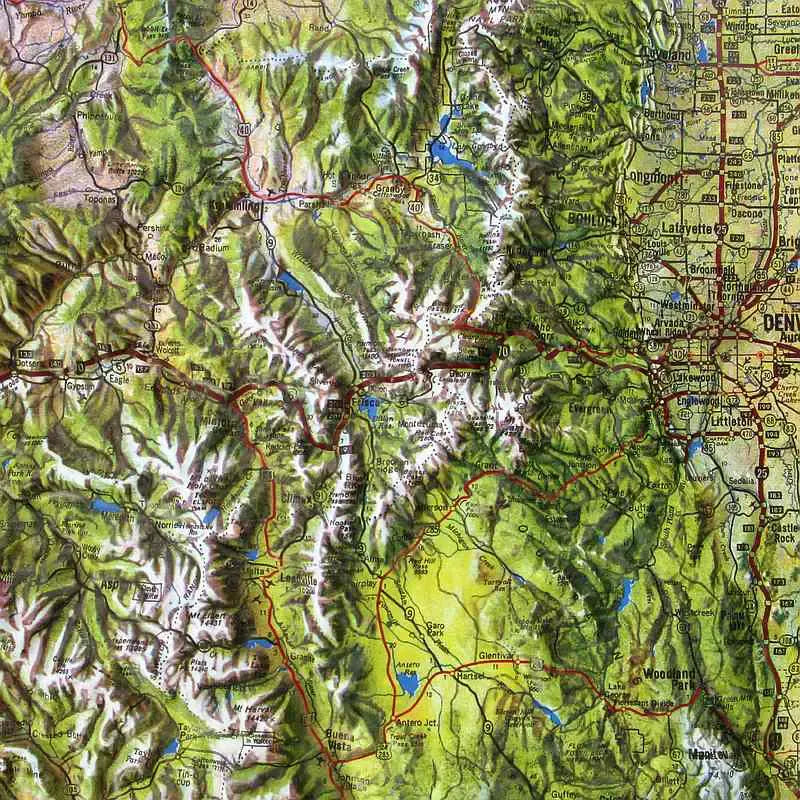
Colorado Raised Relief Map Peaks & Ranges: Colorado is home to some of the most iconic mountain ranges in the United States, and this raised relief map brings them to life in extraordinary detail. Marvel at the towering peaks of the Rocky Mountains, including Mount Elbert, the highest point in the state at 14,440 feet. Trace the contours of other famous “fourteeners,” such as Pikes Peak, Longs Peak, and Mount Evans. The map also showcases the sprawling San Juan Mountains, known for their rugged terrain and rich mining history, and the Sawatch Range, home to many of the state's tallest summits.
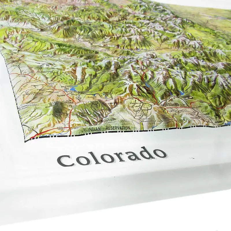
Colorado Raised Relief Map Geographic Features: Beyond its towering peaks, Colorado's diverse landscape includes a range of fascinating geographic features. This map highlights the vast expanse of the Great Plains in the eastern part of the state, the dramatic canyons of the Colorado Plateau in the west, and the high-altitude valleys like the San Luis Valley, nestled between mountain ranges. The map also details the major rivers that shape the state's topography, including the Colorado River, the Arkansas River, and the Rio Grande. Numerous lakes, including the expansive Blue Mesa Reservoir, are also labeled, adding to the map’s comprehensive depiction of Colorado’s natural beauty.
Colorado Raised Relief Map Scale & Design: Crafted with precision and care, this Colorado Raised Relief Map is designed at a scale of 1:1,250,000, meaning that every inch on the map represents approximately 20 miles of real-world terrain. The molded plastic construction gives the map a durable and tactile quality, allowing you to feel the elevation changes as you explore the state's landscape. Each geographic feature is carefully labeled, making this map not only a visual delight but also an educational resource. Whether you’re a geography enthusiast, a Colorado native, or a traveler with fond memories of the state, this map is the perfect way to bring Colorado’s breathtaking scenery into your space.
Size: 22" x 17"