The MapShop
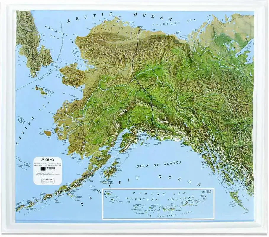
Alaska Raised Relief Map
Alaska Raised Relief Map
Couldn't load pickup availability
Share
Alaska Raised Relief Map: Experience the rugged beauty and unparalleled grandeur of the Last Frontier with this Alaska Raised Relief Map. Crafted from durable molded plastic, this stunning 3D representation brings the diverse landscapes of Alaska to life, making it an essential addition to any explorer’s collection.
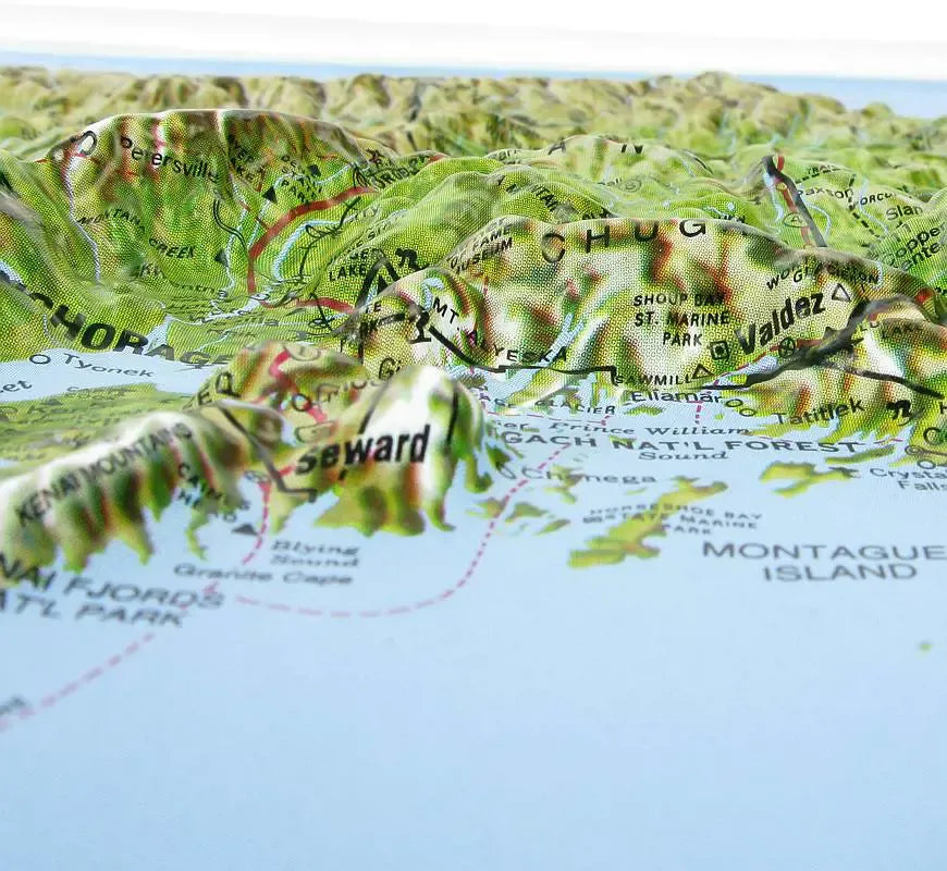
Alaska Raised Relief Map Peaks & Ranges: This map showcases the awe-inspiring peaks that define Alaska’s skyline. Dominating the terrain is Denali, the tallest peak in North America, standing at a breathtaking 20,310 feet. Denali, formerly known as Mount McKinley, is part of the Alaska Range, a prominent mountain range that arcs across the southern part of the state. The Alaska Raised Relief Map’s relief design allows you to feel the rise of this monumental range beneath your fingertips. Venture further west, and you’ll encounter the mighty Wrangell-St. Elias Range, home to some of the tallest and most isolated peaks in the world, including Mount Saint Elias, soaring at 18,008 feet. The Chugach Mountains, another iconic range, hug the southern coastline, offering a striking contrast between towering peaks and the Gulf of Alaska’s icy waters.
Alaska Raised Relief Map Scale & Design: Rivers, lakes, mountains, and towns are carefully labeled, providing a comprehensive view of Alaska’s vast and varied geography. With a scale of 1:5,000,000 (or 1" = 75 miles), the map offers an amazing perspective of the state’s sprawling wilderness. The Aleutian Islands, a chain of volcanic islands stretching over 1,200 miles, are featured in an inset at the bottom of the map, giving you a complete view of Alaska’s farthest reaches.
Perfect for Home, Office, or Classroom: Measuring 24" x 21", the Alaska Raised Relief Map is perfect for display in your home, office, or classroom. Whether you're planning your next Alaskan adventure or simply admiring the state's natural beauty, this map offers a unique, tactile way to explore the Last Frontier. Let it inspire your dreams of discovery and remind you of Alaska's unparalleled grandeur every day.
** Raised Relief Maps are printed on vinyl and are not intended to roll and/or fold. We ship them in a flat box and pack them with love (i.e. Plenty of bubble wrap!) **