The MapShop
Adirondack Park Raised Relief Map
Adirondack Park Raised Relief Map
Couldn't load pickup availability
Share
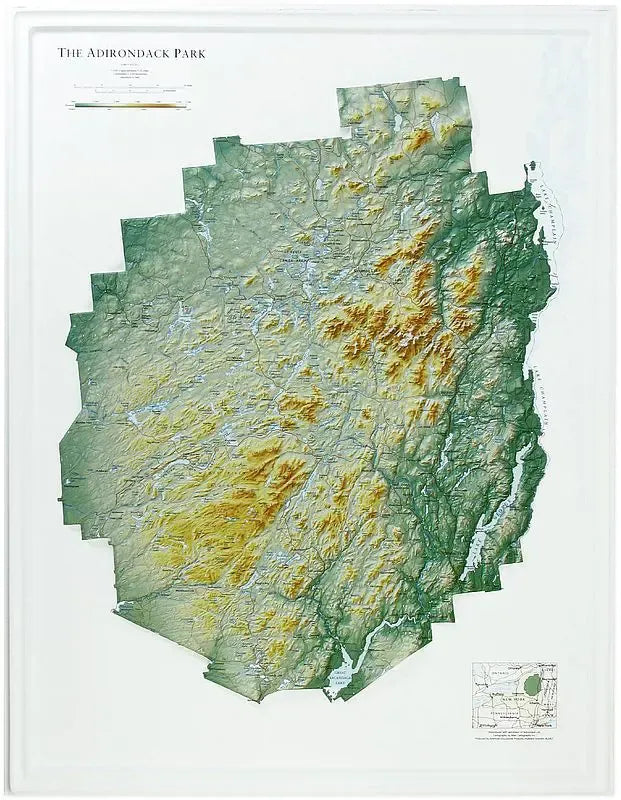
Adirondack Park Raised Relief Map: Explore the grandeur of New York’s iconic wilderness with the Adirondack Park Raised Relief Map, a three-dimensional representation of the largest publicly protected area in the contiguous United States. Crafted from molded plastic, this map offers a tactile experience that brings the park’s diverse landscape to life. With the meticulous labeling of peaks, ranges, rivers, and lakes, it serves as an educational and decorative piece for adventurers, nature lovers, and map enthusiasts alike.
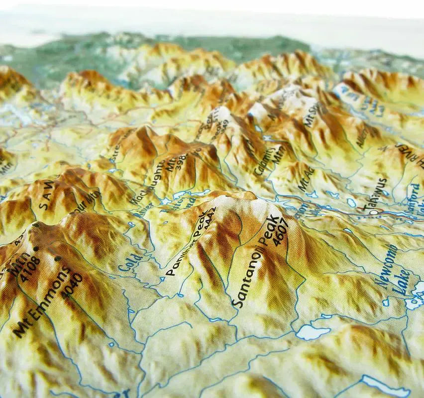
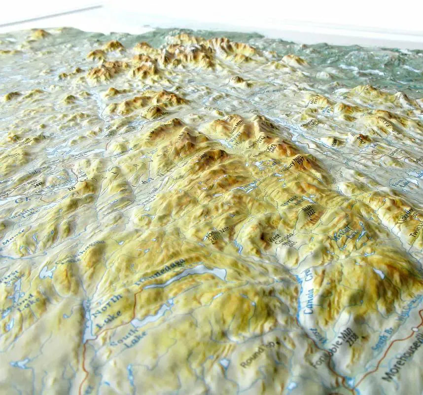
Adirondack Park Raised Relief Map Peaks & Ranges: Discover the towering giants of the Adirondacks, including Mount Marcy, the highest peak in New York at 5,344 feet, and its neighboring summits, such as Algonquin Peak, Whiteface Mountain, and Giant Mountain. Traverse the vast High Peaks Wilderness Area, home to 46 of the Adirondacks’ highest summits, or follow the undulating ridges of the McKenzie and Sentinel Mountain ranges. Whether you're planning a climb, a hike, or a leisurely exploration, this map offers an inspiring view of the park's most notable peaks and ranges.
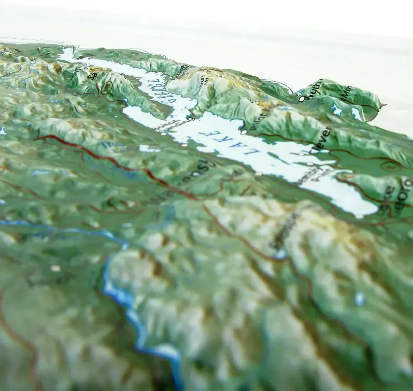
Adirondack Park Raised Relief Map Geographic Features: Adirondack Park is not just about mountains; it’s a mosaic of natural wonders. This raised relief map highlights the park’s vast network of lakes, including the crystal-clear waters of Lake George and the tranquil beauty of Saranac Lake. It charts the course of rivers like the Ausable and Hudson, which carve their way through dense forests and deep valleys. Notable landmarks such as Lake Placid, the site of two Winter Olympic Games, and the scenic Adirondack Loj are also prominently displayed, giving you a comprehensive view of the park's diverse landscape.
** Raised Relief Maps are printed on vinyl and are not intended to roll and/or fold. We ship them in a flat box and pack them with love (i.e. Plenty of bubble wrap!) **