/1004/site-assets/phone.png)
/1004/site-assets/cart.png)
DeLorme Atlas: Exploring America
Exploring America: Navigating the Outdoors with The DeLorme State Atlas
A Little History of DeLorme
David DeLorme founded the DeLorme company in 1976 after his frustration with outdated back-country maps of Maine's Moosehead Lake region inspired him to create a superior map of the state. 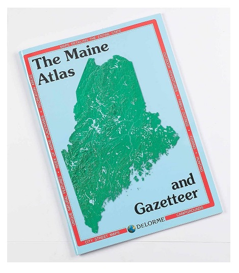
This large-format book initially had a print run of 10,000 copies, which DeLorme sold directly from his car. The Gazetteer, featuring bicycle trails, canoeing and kayaking routes, and listings of museums and historic sites, became a significant success.
What is the DeLorme State Atlas & Gazetteer?
DeLorme State Atlas & Gazetteers are known for detailed topographic maps and comprehensive information on various locations. Designed to cater to outdoor enthusiasts and travelers alike, the atlas is crucial in providing essential navigation details for a wide range of activities, from hiking and camping to sightseeing and exploration.
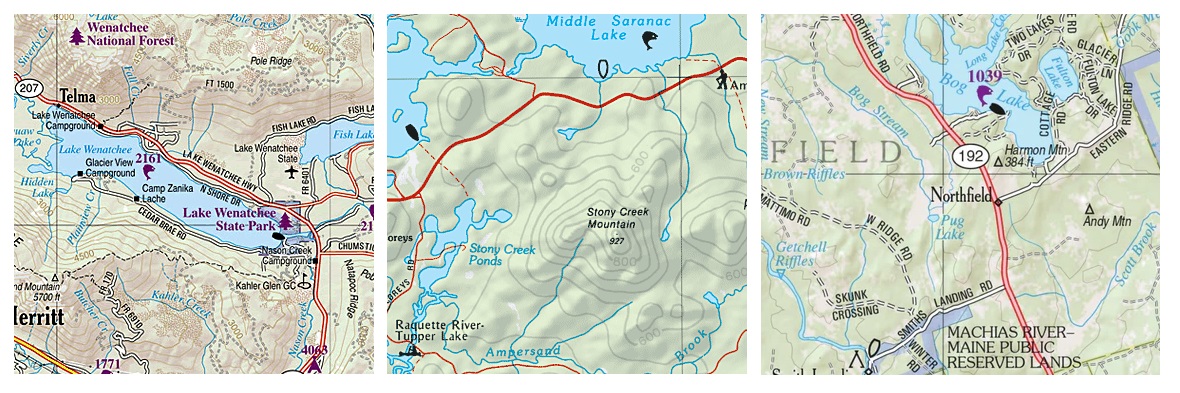
What sets the DeLorme atlases apart is its emphasis on detailed topographic maps that offer a deeper understanding of the terrain and surroundings.
An example that highlights the uniqueness of the State Atlas & Gazetteer by DeLorme is its coverage of major cities, towns and lesser-known historic sites and recreational areas.
This broad spectrum of information caters to individuals seeking popular attractions and hidden gems within a state, making it a versatile tool for adventure planning and discovery.
Key Features of the State Atlas & Gazetteer by Delorme
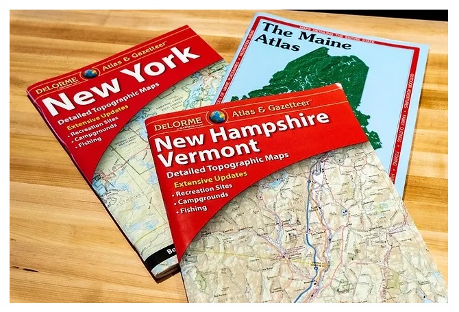
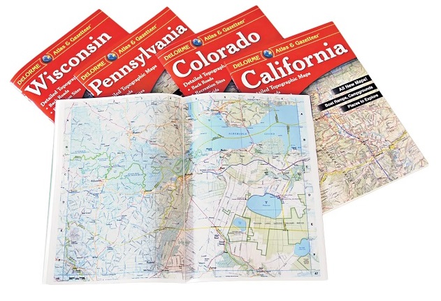
One of the standout features of the DeLorme atlas is the availability of large-format paper maps for all 50 states, ensuring comprehensive coverage for users across the country. These maps include detailed information on cities, towns, historic sites, and recreational areas, offering a holistic view of each state's landscape.
Additionally, including topographic maps, points of interest, and recreational areas in each atlas enhances the overall user experience by providing valuable insights into the natural and man-made attractions within a state.
For instance, the DeLorme atlas highlights significant highways and landmarks and delves into specific points of interest such as parks, campgrounds, and scenic drives.
This depth of information empowers users to plan their trips precisely, whether embarking on a hiking adventure, a road trip, or a historical exploration.
Benefits of Using the DeLorme Atlas & Gazetteer
The DeLorme Atlas & Gazetteer is an indispensable tool for trip planning and exploring backcountry areas. Outdoor enthusiasts, including hikers, campers, and nature lovers, can benefit significantly from the detailed maps and essential information in the atlas.
The DeLorme Atlas facilitates seamless navigation and enhances the overall outdoor experience by offering a user-friendly design with comprehensive coverage and detailed insights.
For example, individuals looking to venture off the beaten path can rely on the DeLorme atlas to discover hidden trails, remote camping sites, and secluded natural wonders.
The atlas guides those seeking authentic outdoor adventures and off-grid explorations, making it a trusted companion for wilderness enthusiasts.
Tips for Efficient Navigation and Exploration with the DeLorme Atlas
To make the most of the DeLorme Atlas, users can leverage the Gazetteer section for essential outdoor information, including key points of interest, recreational areas, and navigational aids. Understanding the scale and legend of the maps is crucial for accurate navigation, allowing users to interpret distances, elevations, and landmarks effectively.
Incorporating latitude/longitude grids provided in the atlas can aid in precise location tracking, especially for GPS-based navigation systems.
For instance, by utilizing the latitude/longitude grids in conjunction with the detailed maps, outdoor enthusiasts can pinpoint their exact coordinates and plan their routes precisely.
This feature enhances safety and navigational efficiency, ensuring a seamless and enjoyable outdoor experience for users relying on the DeLorme atlas.
Customer Reviews, Ratings, and Recommendations
The DeLorme Atlas & Gazetteer series has garnered high customer satisfaction ratings, reflecting the quality and utility of the product.
Customers have praised the accuracy and usability of the maps, highlighting their reliability in various outdoor settings.
Reviewers have provided recommendations for specific outdoor activities and states within the DeLorme atlas collection, offering valuable insights for fellow adventurers looking to make the most of their explorations.
/1004/site-assets/dateseal.jpg "Serving Seattle since 1950")
/1004/site-assets/creditcards.png)