/1004/site-assets/phone.png)
/1004/site-assets/cart.png)
What is a Political Map?
A Political Map is a visual representation of countries, states, and cities, along with significant water features and highways,
that aids in understanding geographic and political features for purposes such as travel planning and education.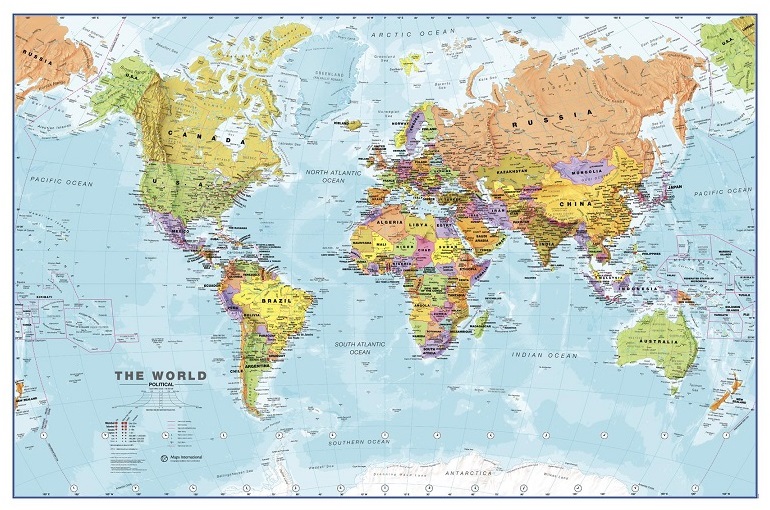
What is a Political Map?
A political map visually represents the boundaries of countries, states, cities, major water features, highways, and towns. These maps are essential for understanding a region's administrative divisions and locations. For example, a political map of the United States shows state borders, capitals, and major cities, clearly depicting the country's political structure. The significance of political maps lies in their ability to aid in understanding geographic and political features, providing valuable insights for various purposes, including education and travel planning.
Moreover, political maps are distinct from physical and thematic maps, focusing on administrative boundaries rather than physical or specialized themes like climate or population density. Unlike physical maps emphasizing natural features like mountains, water bodies, and deserts, political maps highlight man-made divisions and political organization. This distinction makes political maps invaluable for analyzing and comprehending the geopolitical landscape of a particular area, be it at a local, regional, or global level.
Understanding Political Maps
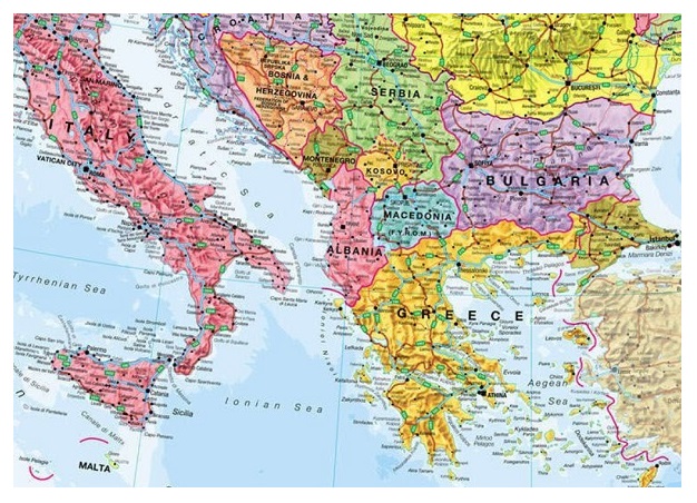
Political maps are designed to display the boundaries of countries, states, and cities, along with significant water features, highways, and towns. These maps are crucial for visually representing administrative subdivisions and human interactions with specific regions. One key feature of political maps is the explicit depiction of political boundaries, making identifying the divisions between countries, states, or cities easy. For example, a political map of Europe vividly showcases the distinct borders of each country, allowing for a comprehensive understanding of the political landscape on the continent.
Compared to other map types, such as physical and thematic maps, political maps have a unique focus on administrative boundaries rather than physical or specialized themes. While physical maps emphasize natural features like mountains, water bodies, and deserts, political maps prioritize delineating political divisions. This distinction is essential for individuals seeking specific geographic information about political structures and administrative regions. An example of this difference is a thematic map showcasing population density, where the focus is on the distribution and concentration of people within a given area, contrasting the administrative boundaries highlighted on a political map.
Importance of Political Maps
Political maps play a crucial role in understanding global and regional politics. By visually representing the administrative boundaries of countries, states, and cities, these maps aid in comprehending historical and current geopolitical relationships and changes. For example, when examining a political map of Europe, one can easily discern the borders of different countries and gain insights into the diverse political landscape of the continent. This can be particularly valuable in understanding the impact of historical events, such as the fall of the Berlin Wall, on the geopolitical configuration of the region.
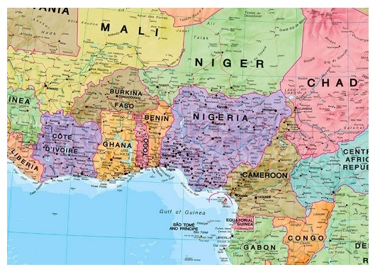
Moreover, political maps serve as educational tools, enabling students to develop a broader world perspective. By studying these maps, students can trace historical changes in political boundaries and comprehend the influence of political decisions on geographic demarcations. For instance, analyzing the political map of Africa can provide students with insights into the historical colonization of the continent and its lasting impact on the current state boundaries. They are enhancing their understanding of global history and geopolitical dynamics.
In addition to their educational significance, political maps are indispensable for travelers, government officials, and students. Travelers rely on these maps to navigate and comprehend geographical contexts, while government officials use them to make informed administrative decisions. For example, a traveler planning a road trip across the United States can consult a political map to identify state boundaries, major highways, and cities. This facilitates efficient travel planning and enhances the overall travel experience. Hence, political maps serve as valuable resources for individuals seeking geographic information and orientation.
Advantages and Disadvantages
Political maps offer several advantages essential for understanding geographical and political features. One of the key advantages is that they provide a clear representation of geographic borders, making it easier to identify countries, states, and cities, along with significant water features, highways, and towns. This makes political maps helpful in finding locations and understanding where something is located, making them valuable resources for travelers, government officials, and students. For example, a political map of the United States clearly delineates state borders, capitals, and major cities, offering a comprehensive view of the country's administrative divisions and key landmarks.
Additionally, political maps serve as valuable reference charts for educational purposes, helping students gain a deeper understanding of geography and political boundaries. They are frequently used in schools to teach students about the world's political divisions, historical changes, and the impact of political decisions on geographical boundaries. Moreover, political maps are essential for understanding global and regional politics. They provide crucial information for analyzing historical and current geopolitical relationships and changes, offering valuable insights into global dynamics and geopolitical scenarios.
Despite these advantages, political maps have certain limitations. They may distort country sizes, potentially leading to misconceptions about the actual dimensions of different countries. This can affect the perception of nations' relative size and scale, a crucial aspect of understanding the world's geography. Furthermore, political maps may place less emphasis on physical accuracy, as they primarily focus on administrative boundaries.
Reading and Interpreting Political Maps
When reading a political map, it is essential to understand the various elements that contribute to its accurate interpretation. The map's title provides crucial information about the specific area or region being depicted, offering a quick reference point for the reader. For example, a political map of the United States indicates the states' and major cities' boundaries and locations, enabling viewers to understand the country's administrative divisions comprehensively.
Additionally, map marks and legend symbols play a significant role in conveying essential information about the map. Symbols such as stars for capitals, circles, dots for cities and towns, and lines for borders and roads are commonly used to represent the features and locations on the map. Understanding these symbols is vital for interpreting the map accurately and comprehending the spatial distribution of political boundaries and urban centers within a specific region. For instance, when examining a political map of Europe, using different symbols for capital cities and smaller towns helps identify the country's administrative and population centers.
Moreover, the scale and compass rose on a political map provide important contextual information. The map scale indicates the distance ratio on the map to the actual distance on the ground, enabling users to gauge the relative distances between different locations accurately. On the other hand, the compass rose marks the map's orientation, indicating the cardinal directions and helping readers understand the spatial relationships between various regions and features. For example, a political map of Africa with a precise scale and compass rose assists in understanding the relative proximity of different countries and the cardinal directions in which they are located.
Conclusion
In conclusion, political maps play a crucial role in understanding the world, offering valuable insights into administrative boundaries, geopolitical relationships, and historical changes. These maps are essential for education, travel planning, and geopolitical analysis, visually representing political divisions and human interactions within specific regions.
For example, a political map of the United States shows state boundaries, capitals, and major cities and towns, giving a comprehensive view of the country's administrative structure.
You'll find various options for your specific needs as you explore the diverse collection of maps and geographic resources Metsker Maps offers.
/1004/site-assets/dateseal.jpg "Serving Seattle since 1950")
/1004/site-assets/creditcards.png)