/1004/site-assets/phone.png)
/1004/site-assets/cart.png)
What is a Map Scale?
If you are heading on a trip and are new to paper maps, you may be curious how you can tell how large an area of the map is or how far apart areas are. Though it's true that a map is a great way to understand how an area looks, it's also confined to a page that fits in your hands. So how do you get a clearer idea of what you're dealing with?
Thankfully there is an easy solution: the map's scale. In this article, we dive into what a scale is, how it works, and what types of scales are found on maps. We're folding up all the information in one neat little package -- just like your map.
What is a Map Scale?
A map scale represents the relationship between the distances on a map and the distances in the real world. It is an essential tool in cartography - the art and science of mapmaking.
A scale indicates the distance on the map. An example of a scale is "1 inch = 1 mile", but there are other forms, which we'll get into in a moment.
The scale is printed on the map, often as a long line or bar with marked segments.
Advantages and Disadvantages of Map Scale
By accurately scaling the measurements, you will understand the size of the area and various features on the map, like mountain ranges and cities. A chief benefit is that it helps you determine how many miles across an area is, to then determine how long it will take to drive across it. You can divide the distance by an estimated driving speed (60 miles per hour if it is a straight road) to determine how long it will take to travel that area.
A disadvantage of scales is the potential for scale variation across different parts of a map. The world is round, and since a map is flat, those horizontal and vertical grids don't accurately represent real life. Still, it's precise enough to get you close. Click for our article on Map Projections for more on this round world to flat map dilemma!
The Types of Map Scales
Here are three common map scales.
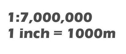
Fractional Scale / Ratio Scale
This scale is represented as a ratio or fraction, such as "1:10,000" or "1/10,000", which indicates that one unit on the map represents 10,000 units in the real world. With a ratio scale, any unit of measurement can be used: millimeters, inches, centimeters, feet, etc. but the same measurement unit must be applied on each side of the ratio.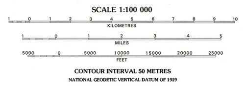
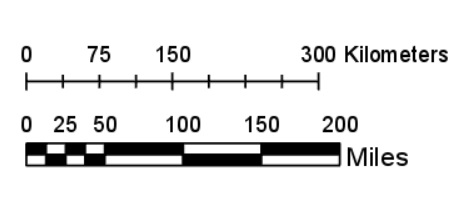
Linear/Graphic/Bar Map Scale
This is a straight line or bar marked with units of distance, such as inches or kilometers, and divided into equal parts. You can use anything as your measuring stick, such as a ruler, pencil, or (you guessed it) a stick to duplicate a given measurement across the bar and then across the map to determine distance.
Verbal Map Scale
A verbal map scale is a way to represent the relationship between the distance on a map and the distance on the ground using words. It is typically expressed in words as a statement, such as "1 inch equals 10 miles." You can then use a ruler to understand the entire distance.
Map Scale Sizes
It's important to keep in mind that not all scales are the same. The scale will change based on the size of the area the map covers on the page. Still, there are three basic categories of maps. Here is a look at each and in what applications they are used most. As you will learn, the size of the map will directly affect how accurate the scale is.
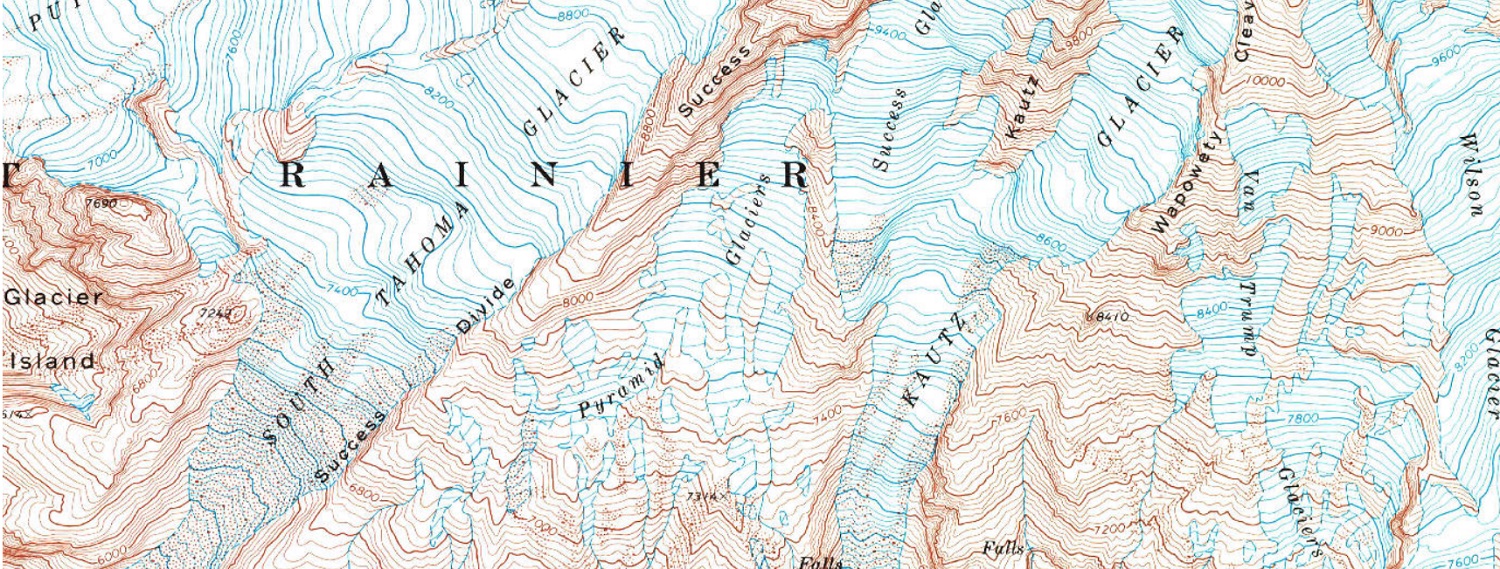
Large-Scale Maps
A large-scale map, like this map focusing on Downtown Seattle, is one that brings a close look at a given area for a detailed representation. This means that objects and features on the map are shown with greater accuracy and detail. When you use your scale, you better understand an item's size and positioning and the distance between objects.
Large-scale maps are handy for navigating urban areas, studying specific geographic features, or conducting detailed surveys. They allow you to visualize and analyze physical and human-made structures of the landscape, like buildings, roads, rivers, and boundaries, in more detail compared to other maps.
Medium-Scale Maps
A medium-scale map is more zoomed out, like this Greater Seattle Area map, providing a moderate level of detail for a given area. They capture enough detail to be useful for navigation and understanding geographic features while still maintaining a broader perspective of the area.
Medium-scale maps are commonly used by outdoor enthusiasts, travelers, and those involved in land planning or development projects.
Small-Scale Maps
A small-scale map captures a large area, such as a region (like this map of Western Washington), country, or even the entire planet. Since each land formation is closer together, understanding exact distances is more challenging, but you get the broadest view for an over-arching understanding of an area.
A small-scale map typically uses a fraction or ratio scale, though some use linear/bar scales for a quick understanding of distances. Small-scale maps are commonly used in atlases and textbooks.
Test Out Your Scale!
Before you head on that next trip, break out your map and test using the scale. After just a few tries, you'll have it down. You will understand an area's size and how long it takes to get to your destination so that you can answer your children whenever they ask you, "Are we there yet?"
/1004/site-assets/dateseal.jpg "Serving Seattle since 1950")
/1004/site-assets/creditcards.png)