/1004/site-assets/phone.png)
/1004/site-assets/cart.png)
What are Map Projections?
Map projections serve as mathematical frameworks that allow cartographers to transfer Earth's three-dimensional surface onto a two-dimensional plane, like a piece of paper or a computer screen.
Since Earth is an oblate spheroid, this transfer inevitably leads to distortions in angles, areas, distances, or directions. Various map projections exist to manage or mitigate these distortions for distinct purposes.
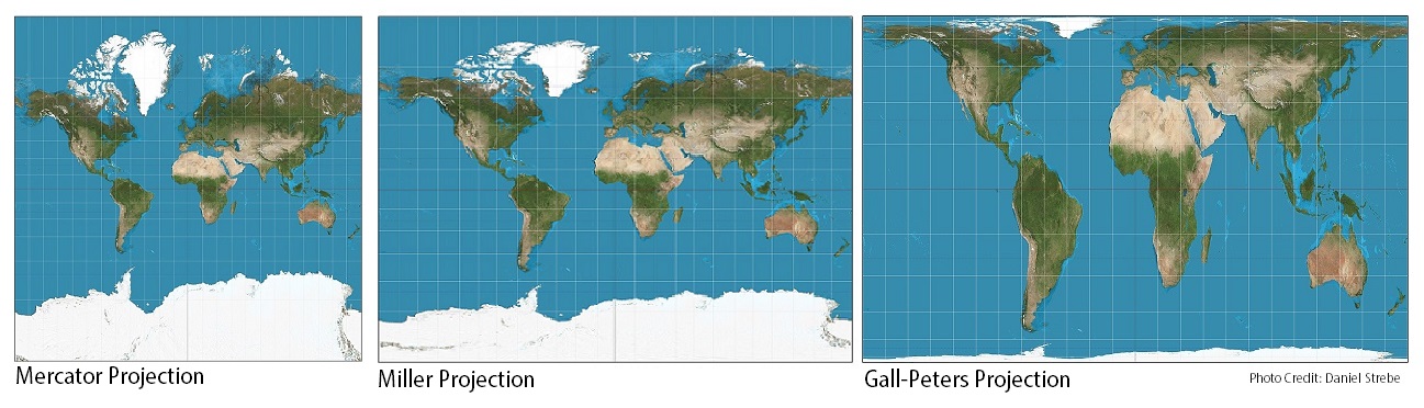
The Mercator Projection, for example, is mostly used for navigation and marine charts. It accurately preserves angles but severely warps area, particularly as you move closer to the poles.
Cylindrical projections retain straight lines for latitude and longitude, but the Miller projection attempts to minimize shape distortion at the expense of area, while the Gall-Peters projection maintains proportional area while greatly distorting shape and distance.
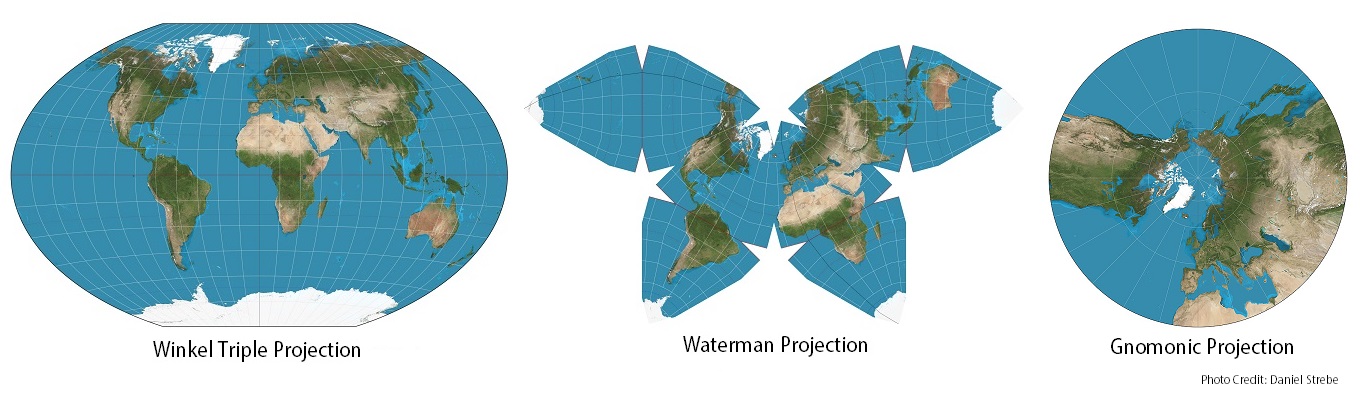
Other projections abandon a rectilinear approach, such as the Strebe projection which maintains proportional area while attempting to minimize shape distortion, or the Cahill Butterfly projection which is not equal area but does an excellent job of maintaining shape fidelity for all the populated continents.
Conic projections, such as the Lambert Conformal Conic and Albers Equal Area Conic, are particularly effective for small countries or regions from east to west. These projections maintain relatively accurate angles and areas within a specific latitude range. Azimuthal projections like the Stereographic, Orthographic, and Gnomonic are used for polar maps, air navigation, or to focus on particular areas. These projections accurately depict directions from a central point but can distort area or shape.
For thematic maps where representing area accurately is crucial, equal-area projections like the Mollweide and Goode's Homolosine are ideal, even though they may distort shapes. Compromise projections, such as the Robinson and Winkel Tripel, aim for a balanced representation of area, angle, distance, and direction. While they don't excel in any aspect, they minimize overall distortion and are frequently used in general-purpose world maps.
Ultimately, because no projection can eliminate distortion, choosing a projection becomes a balancing act, optimizing the most important and critical elements for the given use of the map.
/1004/site-assets/dateseal.jpg "Serving Seattle since 1950")
/1004/site-assets/creditcards.png)